
Project 4: Megathrust seismic hazards by reflection mapping
Project 4: Megathrust seismic hazards by reflection mapping
In collaboration with Lamont-Doherty Earth Observaroty of Columbia University
Funded by the United States National Science Foundation and Natural Sciences and Engineering Reseach Council of Canada
Intellectual Merit. Estimates
of the landward limit of coseismic slip used to forecast the strong ground
motions produced by subduction zone megathrust earthquakes are based on geodetic
models of post-seismic uplift rates and on thermal models that assume that
350 °C represents the limit of brittle fault behavior.
Although sophisticated, such 2-D and even 3-D models cannot represent the
true geologic complexity of the earth. Additional, direct means of imaging
the locked/transition zone boundary are needed to reduce the uncertainty in
its location. Deep reflection images from Cascadia, Alaska, Chile and SW Japan
reveal an intriguing spatial correlation between the seismic reflection
character of the megathrust and its mechanical behavior. In the seismogenic,
locked portion of the megathrust located primarily offshore, the thrust is
characterized by a single reflection event, or a very thin reflection package.
In the transition zone downdip of the locked zone, however, where the megathrust
behavior is thought to gradually change to slow slip, the megathrust reflection package thickens
dramatically and exhibits a more complex signature.
This distinctive reflection signature might make it possible
to directly image and map the location of the locked and transition boundary
with a much higher spatial accuracy than is possible using existing geodetic
and thermal models. Systematic testing of this thehypothesis is important
for achieving short-term improvements in estimating megathrust seismic hazards.
The key to successfully testing the hypothesis is to obtain reflection lines
that cross the downdip boundary between the locked and transition zones.
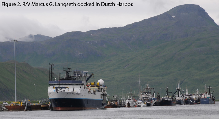
In summer 2011, during an R/V Langseth cruise MGL1110, we carried out a 2D controlled source seismic experiment ALEUT: Alaska Langseth Experiment to Understand the megaThrust. Figure 1 shows the location of collected profiles. Figure 2 shows R/V Langseth. As planned, we divided the cruise into two parts. During the
first part (June 29 – July 12), we scouted selected portions of the planned
MCS program and acquired OBS data. Wide-angle reflection/refraction data were
acquired using the full 6600 cu. in. airgun array towed at 12 m and 21 short-period
4-component Scripps OBS spaced at ~13-16 km along two ~400-km-long profiles
coincident with MCS profiles across the Shumagin Gap (OBS Line 5) and Semidi
segment (OBS Line 3). During the second part (July 12 – August 5),
we acquired MCS data along ~3700 line-km, which included six dip lines (two in
Shumagin Gap, three across the Semidi segment, and one over the Kodiak asperity
within the 1964 rupture patch), a strike line that crossed from the locked Semidi
segment to the freely slipping Shumagin gap, and a series of grid lines primarily
targeting the structure of the downgoing oceanic plate. This was much more data
than we expected to acquire (~2000 km). Most of the MCS data were acquired with
two 8- km-long streamers and the full 6600 cu. in. source. The source and one
streamer were towed at 12 m, while the second streamer was towed at 9 m.
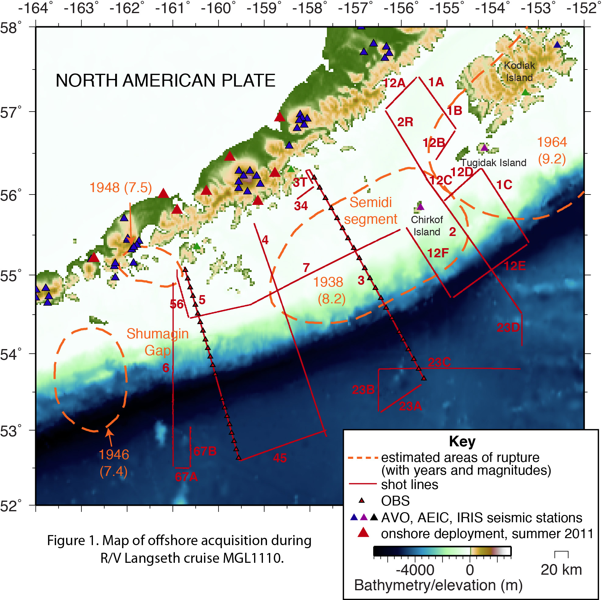
ALEUT investigation focused on the eastern Alaska-Aleutian subduction zone, one of the limited number of places where the locked/transition zone boundary is fully accessible to relatively inexpensive marine profiling. This setting is ideal for the experiment for several additional reasons. The seismic lines cross regions where the downdip limit of coseismic slip is known from large subduction zone earthquakes in 1938 and 1964. The seismic reflection results can also be compared to estimates of the downdip limit of the locked zone that are based on geodetic post-seismic uplift data and thermal modeling. The data were collected in an area that has never been probed with a crustal scale, controlled source seismic survey. The primary goal was to map a 500 km-long stretch of the Alaska-Aleutian megathrust, from the Shumagin gap to just SW of Kodiak Island, and to correlate its reflection signature to its mechanical behavior.
Broader Impacts. The largest earthquakes, with magnitudes greater than 8-9, occur on subduction zone megathrusts. Tsunamis generated by the M9.2 1964 Alaska megathrust earthquake caused the greatest loss of life, but subsidence, liquefaction, other ground failure, and strong ground motions caused extensive damage to Anchorage, containing most of Alaska’s infrastructure. Similar megathrust events pose significant seismic hazard to urban centers in Alaska and in Cascadia (Vancouver, Seattle, Portland) and are of great interest and concern for both scientists and the general public. The single greatest uncertainty in probabilistic seismic hazards maps for megathrust events is the downdip limit of the region of maximum coseismic slip. The proposed study provides a critical test of a recent hypothesis that would, when tested and verified, allow for direct mapping of the downdip end of the locked zone that ruptures during megathrust earthquakes. We focus on the 1938 rupture area, which is likely well along its cycle of strain buildup to the next large earthquake (Sykes et al., 1981; Sykes, 2004). This work will also help further educate the public on earthquake hazards related to subduction systems.
Results. The MCS and OBS data analysis is still underway. The analysis proceeded from far offshore areas (the data collected across the oceanic Pacific Plate, trench and slope) toward the coast. The first results on the origin of dipping structures in fast-spreading oceanic lower crust offshore Alaska were published in Ear. Planet Sci. Lett. (Bécel et al., 2015), with the subsequent results on controls of abrupt along-trench variations in faulting on hydration and therefore seismicity in the Alaska subduction zone in Nat. Geosci. (Shillington et al., 2015) and downdip variations in megathrust reflection
character with Implications for fault structure and seismogenic behavior in the
Alaska subduction zone in J. Geophys. Res. (Li et al., 2015). Additional work on the reflection character of the Alaska megathrust and nature of the megathrust spaly faults with implications for tsunami genertion was published in Nat. Geosci. (Bécel et al., 2017) and Li et al. manuscript in going through second round of review for Geology. Several more manuscripts are in late stages of preparation.